

Suggested route map
The bike route we suggest from the skydiving drop zone to the Downtown Trick-or-Treat Trail. About 0.8 miles. Zoom in, then scroll down the map the way you ride it.
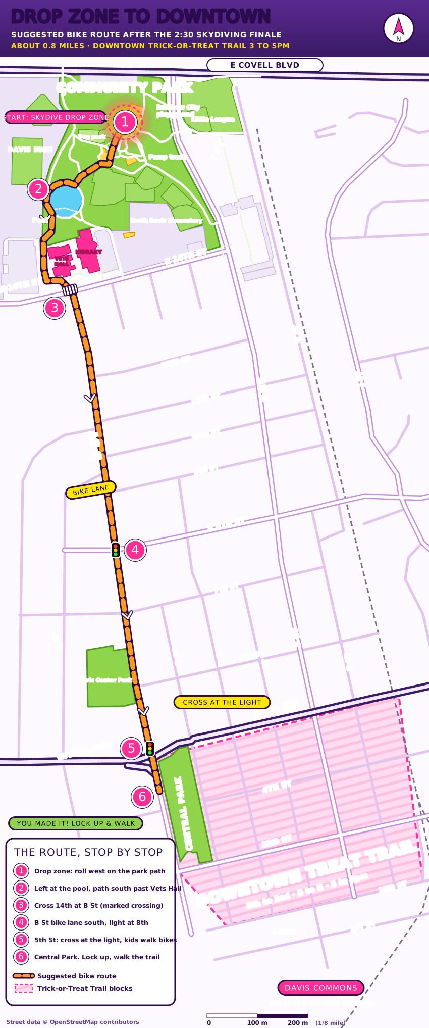
Drag the map to move around it. Double-click to zoom in. On a phone, scroll the map with one finger.
The route, stop by stop
- From the drop zone, roll west on the park path toward the dog park and the pool. Ride slow, the park is full of little kids.
- Turn left at the pool and follow the path south. It runs past the Vets Hall and drops you at 14th Street.
- Cross 14th Street at B Street. Marked crossing. Wait for your whole group, then go together.
- Ride south on B Street in the bike lane for 8 quiet blocks. Cross 8th Street at the light.
- 5th Street: cross at the light. This is the one big street. Kids walk their bikes in the crosswalk. Russell Blvd joins here, so look both ways twice.
- You made it. Central Park is on your left. Lock up, then walk into the trail. Downtown is walk-your-bike territory.
Driving? Leave the car where it is. Downtown parking will be full and the streets around the trail are packed with families.
The Zombie Bike Parade Festival ends at Community Park after the skydiving finale. Travel to the Trick-or-Treat Trail is not a festival activity and is not led, escorted or supervised by festival staff or volunteers. The Trick-or-Treat Trail is a separate event run by the Davis Downtown Business Association. This route is a suggestion only. Follow all traffic laws, wear a helmet, and use your own judgment about road and crowd conditions.